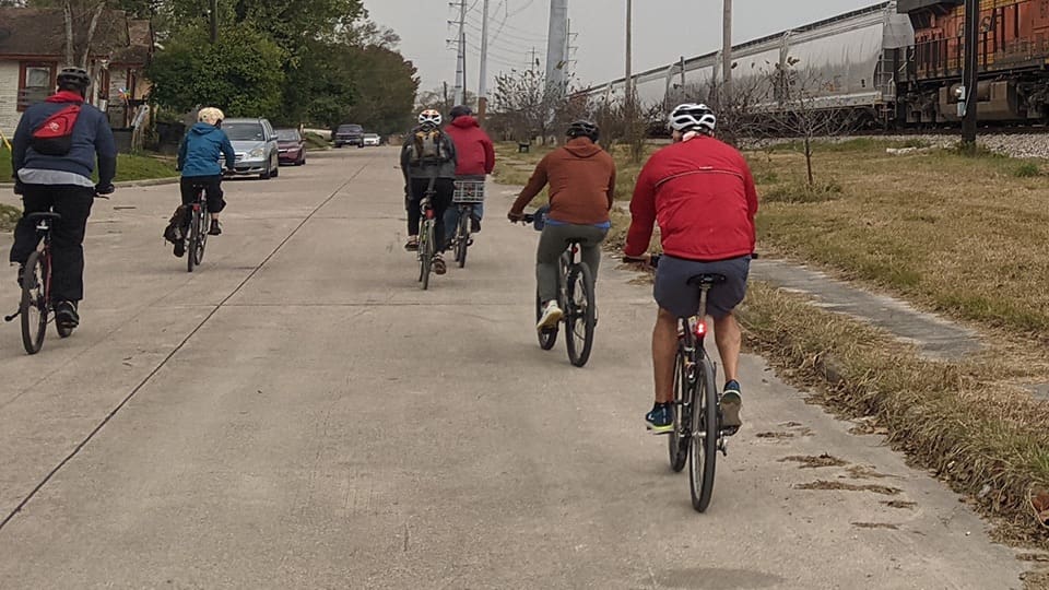
Sampling the City
Air Quality Awareness Fundraiser and Social Ride
December 5, 2020
Purpose:
To raise awareness about air pollution issues and begin to generate more localized data around air quality in Houston.
To raise funds and build a movement which empowers communities with technology to help inform decisions about their health and environment.
About the Data:
This is only a couple of hours worth of data from one day. This is not enough information to begin drawing conclusions about the overall status of air quality along these routes or in Houston more broadly.
The bike rides started at 10am on December 5th, and continued until the early afternoon. Some rides took less than 2 hours; others with a longer route took 3-4 hours. All data collected before 10am and after 2pm should not be considered as part of the experiment.
Pollutants Measured:
- NO2 (Nitrogen dioxide, an ozone precursor);
- VOCs (total Volatile Organic Compounds, an ozone precursor and possible indicator of hazardous organic air pollutants.);
- PM10 and PM2.5 (particulate matter with diameters of 10 and 2.5 microns, respectively)
- Plume Index is a composite measure of all pollutants, indexed by Plume labs.
X-axis indicates the time (24-hour clock) the sample was captured.
Y-axis indicates pollutant concentration, measured in micrograms per cubic meter (ug/m3).
Simms Bayou – Houston Botanic Gardens

The Simms Bayou group, led by captains Michael Skelly and Harris County Commissioner Rodney Ellis, took a 34-mile ride through Precinct 1, making use of the new bike lanes along Simms Bayou and passing by the new Houston Botanic Gardens.

The red color shown on the map indicates high pollution readings between Old Spanish Trail and South Loop. In the chart below, there is a spike in measurement of particulate matter (where PM10 > 80 and PM2.5 > 15) and NO2 (approx 15) around 11am. This can likely be attributed to diesel exhaust from construction equipment and other heavy-duty vehicles operating in that area.

East End – Second Ward

The East End group, led by captains Carol and Charlie Burrus, planned to take a 15-mile ride through Second Ward. The excursion was cut short due to rain, but the group was still able to capture some helpful data on their trip.


The most concerning data (indicated in red and orange on the map) show an NO2 spike (less than 4ug/m3) around 11am, and high PM10 levels shortly after noon. These could be from car exhaust and/or industrial facility emissions, as there are plenty of both along the route. The sporadic lines indicated on the map are likely a result of an unstable/variable GPS connection.

Greater Heights

The Heights group was led by AAH Board President Jonathan Ross. The route was changed at the last minute to account for the safety of the young riders in the group, and therefore did not gather much data along busy streets and major intersections. They did, however, take a nice tour of the Greater Heights bike path.

Joining the team for a ride send-off was David MacLean of McMac Cx Air Champions, who graciously provided the air monitors for the event. David loaned the group his own personal air monitor, so the Heights group was able to capture two sets of data. This comparison is a useful experiment in understanding the calibration and accuracy limitations of these devices.


High pollution levels can be seen in the maps as purple and red, near Tidwell at TC Jester, as well as between Pinemont and 43rd Street. These two monitors show corresponding spikes in PM10 and PM2.5 a few minutes apart, which we expect as the two monitors were travelling at different ends of the bicycle caravan.


Brays Bayou

The Brays Bayou group was led by Elliot Marks. This wild 17-mile ride was a muddy and rainy excursion with detours up and down from the bayou. Nevertheless, the crew prevailed and remained in good spirits throughout their journey; they even encountered the Simms Bayou group along one of the detours, and rode together as one large group for a bit of the way.

For the duration of the ride (between 10am and 1pm), PM10 is variable, exceeding concentrations over 75ug/m3 at times. The NO2 readings are elevated as well, reaching a peak of about 50ug/m3 around 10:30am. Both of these are likely due to automobile emission, exhaust from heavy-duty equipment, and construction dust along the route.
Unfortunately, no map is available for this ride due to the GPS feature of the monitor not syncing correctly with the app.
Downtown

The Downtown group was led by environmental attorney and friend of AAH, Jen Powis. This 17-mile trip made use of some of downtown’s best bike lanes, passing through parts of Third Ward, midtown, downtown, Fifth Ward and 2nd Ward. You can hear Jen talk about her experience during the ride in a recent podcast.

The data show high levels of PM10 and PM2.5 around 11am, which are indicated by the red on the map and seem to have been captured as the group rode along the designated bike greenway (Velasco Street between Polk and Leeland). There is much construction dust and industrial emissions in the area, all of which contribute to poor air quality.

Sheldon

The Sheldon group was led by Airheads founding member Elena White. This 13-mile ride is one of her personal favorite routes to get out of the city and be captivated by the green woods of Sheldon. The group took a tour of three parks along Lake Houston and Sheldon Lake.

There is a dramatic NO2 spike of over 300ug/m3 just after the monitor is turned on (purple and red on the map), which quickly dissipates as the group moves away from their origin point and into the more rural portions of the ride. Elevated PM levels (indicated in yellow on the map) are found at two points along the route, exceeding 30ug/m3 around noon.

Spring Creek Greenway

The Spring Creek Greenway group was led by none other than Air Alliance Houston’s Executive Director Bakeyah Nelson. This 18-mile ride along the newly-finished trails of the Spring Creek Nature Center was something of an ecological respite from urban life. One of the ride participants even had his own personal air monitor, the results of which are posted here.

The NO2 fluctuation in the early morning hours are indicative of instrument calibration as the monitor returns from a period of dormancy. A large VOC spike (> 50ug/m3) just prior to 10am is likely from tailpipe exhaust measured in the parking lot before the ride. Along their journey, the monitor captures small PM10 fluctuations, none of which exceed concentrations of 10ug/m3.
Unfortunately, no map is available for this ride due to the GPS feature of the monitor not syncing correctly with the app.
Lessons Learned
For the next event, we will ensure that the monitors are online and synced to GPS well in advance of the ride to prevent the loss of this valuable data.
To be inclusive of youth and mindful of safety, a Family Friendly ride will be designated in the sign-up process so that routes and expectations are clear.
It was useful to be able to compare two sets of data for a single route, and may be good to include multiple monitors on future rides.
Thank You to our Sponsors